 Place
Place
Continental Divide National Scenic Trail 9
Approximately 50 miles of this trail occupies a portion of the southeast boundary between the Bitterroot and Beaverhead National Forest. A number of developed t...

Search across regions, routes, places, stories, and events — by season, by intent, or by the kind of road you want to be on.
Filtered by your selections.
Place
Approximately 50 miles of this trail occupies a portion of the southeast boundary between the Bitterroot and Beaverhead National Forest. A number of developed t...
 Place
Place
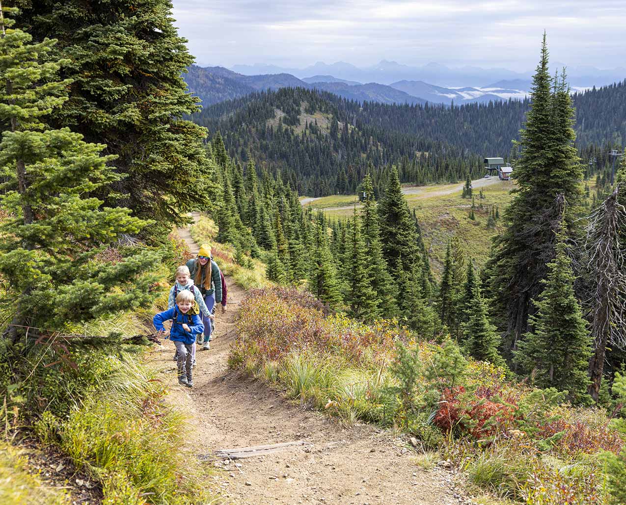
Whitefish Mountain Resort's signature hiking route, the Danny On Memorial Trail takes you from the village area all the way to the summit of Big Mountain, or vi...
Place
Duck Creek Pass Trail provides scenic views from the Belt Divide, fishing and good access to the lakes, mountains, and trails of the Big Birch Creek Basin are t...
Place
East Fork Boulder Trail (27) begins at Box Canyon Trailhead and parallels the East Fork Boulder River to Slough Creek Divide. This popular route is used to acce...
 Place
Place
The Edith Lake Trail is moderately difficult due to uphill grade and rocky surface. The trail climbs above timberline to a saddle where you have views of both t...
Place
The Larabee Trail was rebuilt in 1978. This is now a very good trail with two switchbacks added and much of the upper trail rerouted. When the trail reaches its...
Place
Little Hellgate Gulch Trail is a ridge trail, mainly used for hunting. The trail passes through private land within the forest boundary and the government does....
Place
Lodgepole Trail (124) begins at the end of Elk Creek Road 2606 and travels to Meyer Creek Divide and the Custer National Forest. It provides access to most trai...
 Place
Place
Lonesome Spur Ranch is a fifth generation working ranch, 45 miles south of Billings on Highway 310, between the Beartooth and Pryor Mountain Ranges. We invite y...
 Place
Place
Refrigerator Canyon Trail (259) is a scenic trail leading into the 28,560-acre Gates of the Mountains Wilderness Area. The first quarter-mile is truly spectacul...
Place
Review Mountain Trail (113) offers outstanding views of Canada and Glacier National Park. The elevation gain on this trail is 2,641 feet. This trail provides a....
Place
Stanton Creek Trail offers outstanding and seldom seen views of Glacier National Park, the rugged Middle Fork Divide, and Hungry Horse Reservoir. Hike up the St...
 Place
Place
This gem of a home is situated at the shore of Echo Lake. The ultimate mountain location for peace and tranquility. Walk out the door to unlimited adventures! T...
Place
The Tizer Poe Park Trail is in the Elkhorn Mountains. At one time this trail was called the Poe Park Driveway because it was used to drive cattle to Poe and Man...
Place
The road through Trout Creek Canyon was once part of the Figure 8 Scenic Route; this three-mile stretch was destroyed during a spring flood in 1981 and has been...
Place
Maintained yearly. The first 7 miles are considered easy but the remaining 2 miles are difficult. Trail open to over highway vehicle use. Not suitable for 3 or....
Place
West Fork Upper Deer Creek Trail (108) starts at the end of the Cherry Creek Road 206. It travels south along the West Fork of Upper Deer Creek to the junction....
Review current fire restrictions and air quality before outdoor plans.
) Story
Story
Before setting out on your off-highway vehicle this summer, it’s important to make sure you’ve got the proper permits to traverse the terrain. Not sure where to...
Check park access requirements, timed-entry reservations, and shuttle updates before your trip.
Follow Leave No Trace practices, respect closures, and recreate responsibly on public and private lands.
Check closures, chain requirements, and active construction before driving.
Pack for rapid weather changes and elevation swings, even in summer.
Monitor road cameras, weather alerts, and traction requirements before mountain travel in winter.