 Place
Place
Flip Burger & Treats
Flip Burgers and Treats offers mouthwatering, hand-pressed burgers made from locally ground beef, served with your choice of side. Craving something sweet? Look...

Search across regions, routes, places, stories, and events — by season, by intent, or by the kind of road you want to be on.
Filtered by your selections.
Place
Flip Burgers and Treats offers mouthwatering, hand-pressed burgers made from locally ground beef, served with your choice of side. Craving something sweet? Look...
 Place
Place
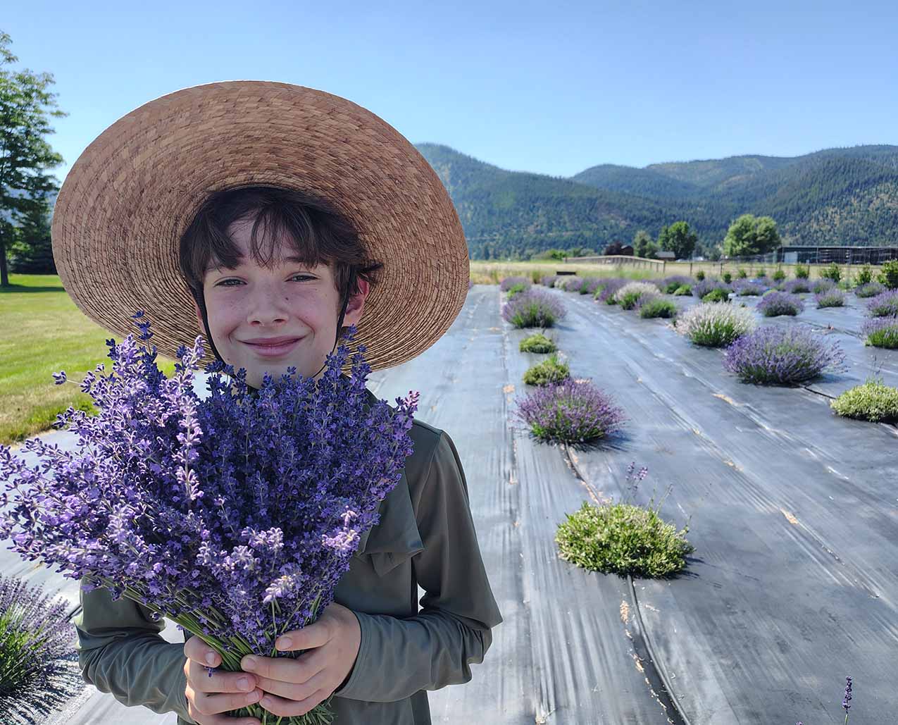
Our field was meant to be shared. Come experience a Lavender U-Pick visit at Forsythe Farms—just 20 minutes from Missoula in beautiful Frenchtown, Montana. A vi...
 Place
Place
On the border of Glacier National Park, our resort offers individual one or two bedroom log homes. Each unit is equipped with a fireplace, complete kitchen with...
 Place
Place
Haynes Pavilion and Ressler Motors Ice Rink at the Ice Barn are home to recreational ice in the heart of Bozeman. The facilities are managed and operated by the...
 Place
Place
This annual four-day celebration takes place the second week in August. Heart Butte is one of the oldest traditional communities of the Blackfeet Reservation. W...
 Place
Place
The Longbranch Saloon has been open since 1931, located on Main Street of Ennis offers friendly pesonal service to all our customers with a full service bar and...
 Place
Place
Epitomizing the peaceful yet adventurous spirit of the Mountain West, Montage Big Sky invites guests to experience the rugged beauty of Montana’s Big Sky Countr...
 Place
Place
3 Bedrooms, 4.5 Bathrooms, Occupancy 10, Ski In and Ski Out Access Eye-popping views of the Spanish Peaks and serene, pine forest surroundings provide the perfe...
 Place
Place
3 Bedrooms, 4.5 Bathrooms, Occupancy 10, Ski In and Ski Out Access For absolute convenience and total luxury, look no further. This ski-in/ski-out Moonlight Pen...
Place
Moser Creek/Bozeman Creek Trail offers mountain bike opportunities in summer months and cross-country skiing in the winter. The trail travels from from Moser Cr...
Place
Hotel on Highway 200 just down the road from the Garfield County Museum and other great adventures!
 Place
Place
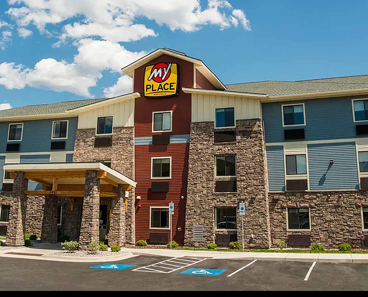
My Place is located at 2951 Expo Pkwy. off I-90, exit 101. Easy access to several restaurants, historical downtown shopping, The University of Montana, Snowbowl...
Place
Pizza Hut, is Pizza Hut, is Pizza Hut, right. WRONG! Not in Bozeman, Montana. We have a dining experience you can't get at any other Pizza Hut, from our ranch p...
 Place
Place
5 Bedrooms, 4 Bathrooms, Occupancy 14, Ski In and Ski Out Access Located in a private wooded setting with beautiful forest and mountain views, this luxurious Po...
 Place
Place
5 Bedrooms, 4 Bathrooms, Occupancy 16, Ski In and Ski Out Access With plenty of picture-perfect forest and mountain views, this luxurious Powder Ridge log cabin...
 Place
Place
Join 3 of the country’s top instructors for this unique, one-of-a-kind course. Experience hands-on instruction from experts. Learn your skills with practical ex...
Event
The Powder River Historical Society will dedicate its new “Reynolds Fight: Battle on Powder River” exhibit on Saturday, June 13, 2026, at the Powder River Histo...
Place
Ross Creek Overlook does not provide a vantage point of great height, but the traveler obtains a dramatic view of the Cabinet Mountains and Bull Lake Valley. Th...
Place
At Ryan Stefek Outfitters, we offer custom-guided hunting and fly fishing trips built around the seasons and the ground we know best. Based in Fort Smith, Monta...
 Place
Place
4 Bedrooms, 3.5 Bathrooms, Occupancy 12, Ski In and Ski Out Access Larger than life views of Lone Peak and Andesite Mountain make this majestic home an inspired...
Place
Mexican American Fast-Food Restaurant
 Place
Place
Welcome home. This gorgeous 3 bedroom, 2 bathroom home has all comforts of home are waiting for your arrival. This spacious, private home is conveniently nestle...
Place
Therriault Ski Trail provides an opportunity for the cross-country skier to easily access high country surrounding the Tobacco Valley. Views of the Ten Lakes Sc...
Place
Vista Motel invites you to relax and enjoy our spectacular view of Glacier National Park. We have 21 rooms, 2 small cabins, and 2 large cabins with kitchens. We...